Somerset (wetlands, Western-super-Mare & scrumpy!)

The Somerset Levels feel simple at first, just flat land and open air. Then you notice the water, the way it sits in the fields, the way it threads through ditches and channels, the way the sky seems to take up most of the view.
One of England’s most important wetlands, they feature wide skies, rhynes, peat soils, winter floods, and the steady work of keeping a wet place liveable. They are a haven for local wildlife, thanks to reed beds and shallow lakes. Bitterns, marsh harriers and thousands of winter starlings call this place home. Along with cranes (England’s tallest birds) who have returned after 400 years.
If out walking, follow the Countryside Code to keep all creatures safe. Keep dogs on leads near steep banks (and away from toxic spring bulbs).
If at the coast, read how to keep dogs safe by the seaside (check for beach bans, before travel).
Wide skies (and the calm they bring)
The first thing that lands is the sky. Because the land is so flat, the horizon runs long, and the light travels without much to stop it. Even on a grey day, the cloud shapes feel close and readable.
In clear weather, the Levels can look almost spare. As a result, small changes stand out, a patch of mist, a line of willows, a flock lifting off at once. The space does a lot of the work, and you don’t need much else.
Wetlands that behave like a living system
The Somerset Levels are wetlands, but not the kind you only look at from a boardwalk. This is a working wetland, held in place by people and maintained over time, yet still full of natural motion. Water levels shift, plants spread, and birds arrive and leave with the seasons.
It helps to think in layers. There’s surface water, soaked ground, and deeper flows, and each layer shapes what can grow. Meanwhile, the wet ground holds its own kind of quiet, soft edges, muted sound, and slow changes.
Rhynes (drainage ditches store water)
Rhynes are the drainage ditches that run beside fields, lanes, and footpaths. They look plain, but they’re one of the key features of the Levels. Because they carry and store water, they help manage wet ground through the year, especially when rain stacks up over days.
The rhyme of them is visual as well as practical, water, grass, reeds, then water again. In addition, they act as wildlife corridors, linking ponds, fields, and bigger rivers. Stand by a rhyne long enough and you’ll notice the small life, beetles, snails, water plants, and the steady flicker of movement near the surface.
The River Axe (gathers rain from higher ground)
The River Axe matters here because rivers don’t just pass through, they collect. A catchment gathers rainfall from higher ground, then brings it down into flatter places, and that shapes flood risk and water quality. So even when you’re standing on low land, the story stretches back into the hills.
Along the Axe, the water can look gentle while it still carries force. After heavy rain, it rises and spreads, and that affects nearby fields and rhynes. In other words, one river links a lot of decisions, where water goes, how fast it moves, and what happens when it can’t drain away quickly enough.
Peat soils (stores carbon, holds water)
Large parts of the Levels sit on peat soils. Peat forms slowly, from layers of plant matter building up in wet conditions where it can’t fully break down. Because of that, it stores carbon and holds water, but it also changes when it dries.
Drain peat and it shrinks. Then the land surface can lower over time, which makes flooding and drainage harder. So peat isn’t just a soil type here, it’s part of the long balance between farming, water management, and keeping the land stable.
Read reasons to avoid peat compost (keep fresh compost away from pets).
Winter floods (happen a lot here)
Floods in the Somerset Levels aren’t a rare surprise. They’re part of how this place works, especially in winter, when rivers run high and fields hold water for longer. Sometimes the water looks almost tidy, a sheen across grass, a mirror for the sky, but the impact is serious for homes, roads, and livelihoods.
The hard part is time. A flood that lasts days feels different from one that lasts weeks, and recovery adds its own strain. Still, the Levels have always been about managing water rather than pretending it isn’t there.
Birds on the Levels (need space and wetlands)
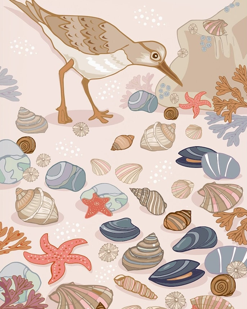
Birdlife fits the Levels because it needs room and water. Wet fields, rhynes, and reedbeds create feeding and nesting spots, and the open layout lets flocks move without much obstruction. As a result, you often see birds at a distance first, a shifting line, a sudden lift, a drift back down.
In colder months, the sense of scale grows. A big flock can turn a quiet view into something busy and alive, even when the rest of the scene stays still. Besides, bird calls travel far over flat ground, so you hear more than you see at first.
Raft spiders (the hidden hunters on wetlands)
The Somerset Levels are one of the few places in England where raft spiders live (they sit near bogs and ‘float’ while catching prey. They live around ponds, ditches, and slow water, and they can move across the surface by using surface tension.
They’re easy to miss if you rush. Still, a slow walk by a sunny rhyne can reveal a lot, reed shadows, water skaters, and the quiet, poised stillness of a spider waiting. If you spot one, keep your distance and let it carry on, because the point is watching (not disturbing).
Reedbeds and willows (soft borders)
The Levels don’t rely on big landmarks. Instead, they use borders, reeds fringing water, willows leaning over ditches, hedges breaking wind across fields. These features give shelter to wildlife and shape the feel of a walk, even when the route looks straight on a map.
Reedbeds, in particular, change the sound of a place. Wind passes through them differently, and birds hide inside, calling from cover. Meanwhile, willows often mark wetter ground, so they become a quiet signpost for where water sits and returns.
Managing water (sluices and pumps)
Water management on the Somerset Levels is ongoing work, not a one-off fix. Channels need clearing, banks need checking, and water levels need adjusting across seasons. Because the land sits low, small changes in flow can make a big difference.
There’s also a human rhythm to it. People monitor, maintain, and respond, especially after prolonged rain. So the landscape you see, tidy rhynes, defined drains, passable tracks, comes from routine attention as much as from nature.
How to protect the Somerset Levels
Stick to paths where you can, because soft ground and bank edges damage easily. Keep dogs under close control near livestock and ground-nesting birds, and close gates behind you.
Don’t drop litter, even small things like bottle tops, food wrappers, or fishing line. It ends up in water, and then it becomes a hazard for birds and animals. Avoid using drones as well, because they disturb wildlife and can stress flocks, especially in winter and during nesting season.
The Gwent Levels in Wales (a useful comparison)
The Gwent Levels are flat, wide and quiet with reens (drainage ditches), sea walls, and big birdlife if you pause long enough to view from afar. This Stolen Land tells the story of these wetlands that line the north shore of South Wales’ Severn Estuary.
Welsh wildlife TV presenter Iolo Williams is passionate about the Gwent Levels, and is very vocal about needing to protect them from development. He says they are a ‘jewel in the crown of Wales’ with fragile wetlands that need protection, as a matter of urgency. He once told former Prime Minister Boris Johnson ‘Keep your money-grabbing mitts of the Gwent Levels’.
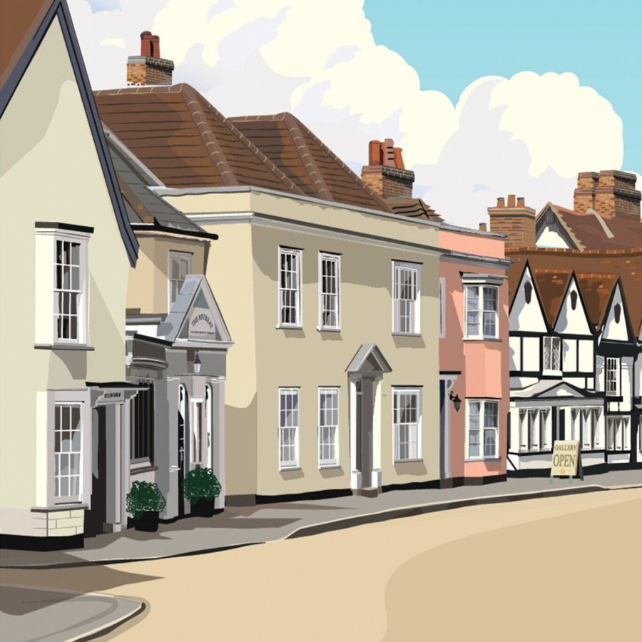
Weston-Super-Mare, Somerset (a classic seaside resort)
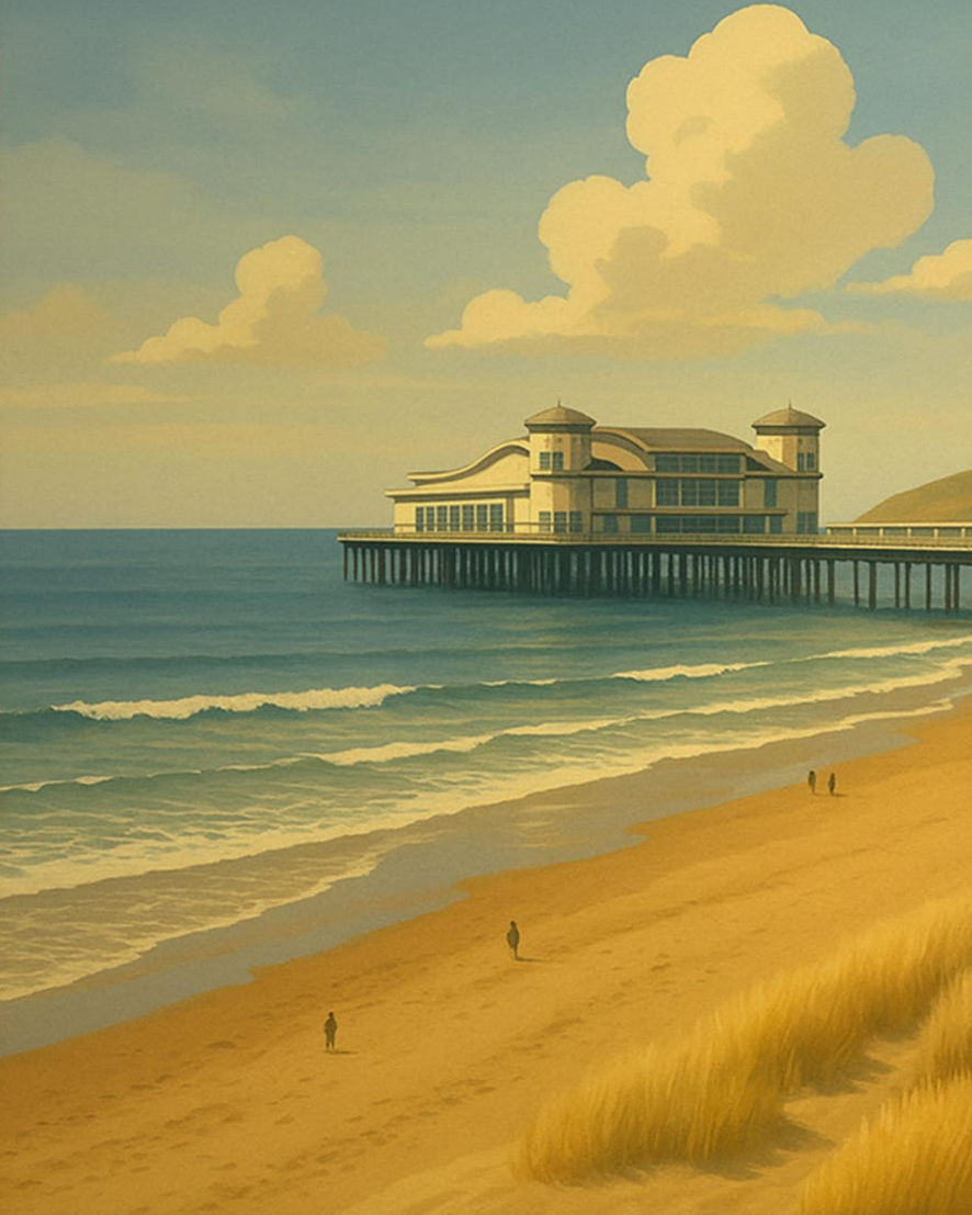
Known for a wide sandy beach, Weston-super-Mare is a popular place that lets you see all the way to Wales, on a clear day. Names after Old English for ‘west settlement’ (super-mare is Latin for ‘above the sea’).
What makes Weston stand out is contrast. It’s bright and busy around the seafront, then suddenly quiet if you drift a little south towards the headlands.
If out walking, follow the Countryside Code to keep all creatures safe. Keep dogs on leads near steep banks (and away from toxic spring bulbs). If at the coast, read how to keep dogs safe by the seaside (check for beach bans, before travel).
Weston Super Mare has the second-highest tidal range in the world, so follow signs to avoid high tides and quicksand. Marine Lake is a manmade body of water that offers a safe swimming area, when the tide is out, though dogs are not allowed.
Mud flats & quicksand (steer clear of hazards)
That dramatic tidal range comes with hazards. Weston’s mud can behave like quicksand in places, especially where water drains through soft silt.
So it’s worth taking the warnings seriously, and keeping to firm sand and marked areas. Even if it looks solid, the surface can shift underfoot, and the tide can cut off routes back.
The wide beach (endless at low tide)
Weston’s beach is big, open, and built for wandering. At low tide it can feel almost endless, with long, flat stretches that make everything look extra wide.
Because the space is so generous, it works for different moods. You can sit close to the promenade with a coffee, or walk far enough that the town drops behind you.
Bristol Channel tides (one of the world’s longest)
The tide is part of the show here. The Bristol Channel has one of the longest tidal ranges in the world, so the sea can seem to vanish, then return fast.
As a result, the beach changes by the hour. The view at high tide feels coastal and neat, while low tide turns the foreground into mud, ripples, and long shining bands of wet sand.
Grand Pier (the bright heart of the front)
Grand Pier is the postcard moment, all lights, colour, and noise. It’s where the seaside resort energy gathers, with amusements, treats, and plenty of movement even on cooler days.
Meanwhile, it’s also a handy marker for the day. Meet by the pier, walk one way for busy, the other for calmer, then come back when you want warmth and shelter.
The promenade (made for people-watching)
Weston’s promenade is easy walking, with space to stop without feeling in the way. You pass benches, shelters, cafés, and the steady rhythm of families, dog walkers, and day trippers.
In addition, it’s a good way to read the town. The closer you are to the central stretch, the more traditional it feels, with familiar seaside sights and a gentle bustle.
Better welfare for donkey rides
Alas the town is one of the few seaside resorts that still offers donkey rides for children. Unlike abroad, donkeys here are inspected for welfare, but most parents now are choosing to move on from donkey rides.
Marine Lake (a calmer patch of water)
When the tide is out, the lake still sits there, contained and steady. That difference matters, because it gives Weston a more settled place to pause when the beach looks wild and empty.
Also, it’s a nice spot for a short loop walk. You can keep things simple, stay close to the railings, and watch how the light changes across the water.
The town centre (minutes from the seaside)
The town of Weston sits close enough that you don’t need to plan it. You can go from the seafront to shops and cafés in minutes, then return without it becoming a separate trip.
Also, it’s useful when the weather changes quickly. If rain comes in, you can shift indoors, slow down, and let the day reset.
Uphill village (for a quieter coastal corner)
Head south and the mood changes. Uphill village feels smaller and steadier, with a slower pace and a more local feel.
So it’s a good counterpoint to central Weston. You can walk, look back towards the bay, and feel the coastline get a bit more rugged and less staged.
Uphill Hill gives you the kind of view that makes the tides feel even more dramatic. From above, the flats, channels, and shifting water lines make more sense.
Sand Point (a short trip for sea air)
Sand Point sits nearby and offers a different sort of coastline, with higher ground and sharper edges. It’s a good place for a walk that feels more like a proper outing than a seaside stroll.
Keep dogs away from cliff edges, grazing sheep and obey local safety rules.
Brean Down (the wilder side of the bay)
Not far from Weston, Brean Down gives you another strong headland walk. It’s open, windy, and satisfying in a plain way, especially when the sea is rough. Then, when you go back into town, Weston feels warmer and more sheltered.
The birthplace of Jill Dando

Jill Dando was raised here, and there is a memorial garden in her name, after her tragic murder. ‘Jill’s Garden’ took 3 days of work by the BBC Ground Force team, and contains her favourite flowers (roses, lavender and trees) plus a foaming fountain, a disabled ramp and a sensory garden.
Founded in her memory, The Good News Post is an online digital newspaper, packed with good stories. It’s powered by an ‘expanding army’ of young journalists age 7 to 18. Her journalist brother also helps out.
Jill grew up in the town, her first job being on a local newspaper. Born with a hole in her heart, she had surgery to correct it, and was a committed Baptist Christian for the rest of her life.
Of course, there was great tragedy when age 37, she was shot dead outside her home in London, and the killer has never been found (despite the largest investigation since the Yorkshire ripper).
She presented the first episode of an antiques show, just one day before she died. Some believe she was shot in revenge for hosting a BBC Kosovo Crisis appeal, which raised over £1 million in 24 hours, just before she died.
Diana Dors was the local beauty queen!
Blonde bombshell actress Diana Dors placed third in her first beauty contest here, back in 1947. Born in Swindon, there are still surviving contests, showing the contestants. The winner was Miss Beryl Smith!
Nowadays beauty contests have gone out of fashion, but back then it was all a bit of harmless fun. Local people recall her visiting a nearby cafe to have a ‘natter’ during her visit.
Born Diana Mary Fluck, she went onto become a major film star. Catch her without her make-up in the film Yield to the Night, based on the last days of Ruth Ellis, the last woman to be hanged. Boy, could she act.
After her death, her son could never find the estimated £2 million of her fortune hidden in European banks, because she had given the code to her third husband, who committed suicide from grief, after her death from cancer.
Glastonbury, Somerset (not just a music festival!)
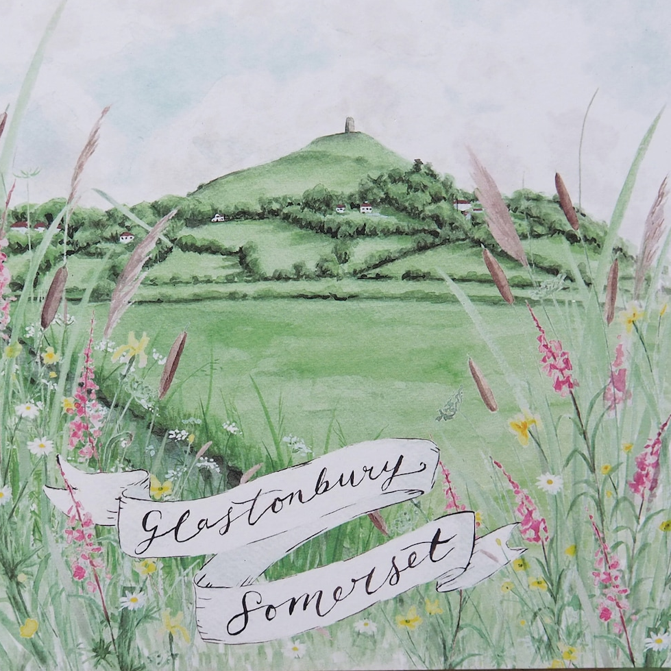
Glastonbury (Somerset) is of course best known for being the home to the world’s biggest music festival (it’s actually held in a nearby village). But that’s not the only reason to visit. Home to a stunning Tor, a quirky town and nearby sights like Wells (England’s smallest city), there are plenty of other reasons to visit.
Walk up Glastonbury Tor
Glastonbury Tor is the obvious start, because it sets the scene in minutes. The climb is short, but it makes you work just enough to feel you’ve arrived somewhere.
At the top, St Michael’s Tower stands stripped back and weathered, which suits the hill. On a bright day, the views to Somerset Levels spread out in a wide, calm sweep, with lanes, fields, and water lines catching the light.
Most people head up and down the same way. If you take a wider loop, the Tor changes shape as you walk, and the hill stops being a single postcard shot.
This slower route gives you space, and it also frames the town below. As a result, Glastonbury town feels less like a cluster of shops and more like a place sitting in its landscape.
St Michael’s Tower (look out, not down!)
St Michael’s Tower is all that remains of an older church, and it reads like a marker more than a building. The stone feels plain and direct, and that simplicity helps, because the setting does the rest.
From up here, the horizon does most of the talking. The views to Somerset Levels can look soft and almost coastal, especially when the air turns hazy and the land flattens into pale greens and silvers.
Visit Glastonbury Abbey (history you can feel)
Glastonbury Abbey sits close to the centre, yet it feels set apart. You step through, and the noise drops a notch, even on a busy day.
The ruins don’t need much explanation to land. Besides, the site connects to the Isle of Avalon story, which hangs around the town in a quiet, persistent way, even if you treat it as legend rather than fact.
It’s tempting to do a quick circuit and move on. However, the Abbey rewards a slower pace, since the stonework, grass paths, and open spaces keep shifting your attention.
Spend time with the Isle of Avalon story
The Isle of Avalon story sits all over Glastonbury, in shop names, guidebooks, and local talk. Still, you don’t have to sign up to anything to enjoy it:
It’s a mythical island in Arthurian legend, renowned as a place of healing, and the final resting place of King Arthur. Following the Battle of Camlann, a mortally wounded Arthur was taken there by Morgan le Fay to recover, with legends suggesting that he remains there, waiting to return.
Go to Chalice Well Gardens (stillness & shade)
Chalice Well Gardens feels like a small world of its own. The paths twist through trees and flowers, and the whole place carries a gentle hush, even when other visitors are around.
Water sits at the centre of the experience, and it sets the tone. Meanwhile, benches and sheltered corners make it easy to stay longer than planned, because nothing pushes you to keep moving.
Notice the red spring at Chalice Well
The iron-rich water is famous for its colour, and it catches people off guard. It looks intense, yet it’s just water doing what water does, shaped by the ground it travels through.
Don’t drink this water, it can make you sick (iron oxide is also toxic to dogs, the same reason to wash your face after using sunscreen or cosmetics).
You can walk from Chalice Well to the Tor, if you’re feeling energetic. This route also gives you a nice rhythm, garden calm, hillside climb, then town again.
Glastonbury High Street (many indie shops)
Glastonbury town is known for its alternative streak, but it’s not all crystals and tarot cards. You can also find independent bookstores, shops that sell classic music and small cafés.
You’ll find plenty of places to grab lunch, a pastry, or a proper cup of tea. Some are clearly visitor-friendly, while others feel more like everyday spots for locals.
Glastonbury Music Festival (in nearby Pilton)

Glastonbury music festival is actually held near the village of Pilton, whose population swells from 1000 to 200,000 each summer. The locals don’t mind that much, as the festival-goers are a pretty peaceful lot, and obviously bring in income for the pubs!
The festival does generate huge amounts of litter. But it has things in order, with chosen litter pickers (who get their own campsite with flushing toilets and meal vouchers) going into action when the festival ends.
Leaving the place pristine within a few days. Unusual items found include:
- A grandfather clock
- A bra with poo in it
- A wig that someone had vomited in
- People sleeping under piles of clothes!
Read tips for greener music festivals.
Near to Wells (England’s smallest city)
If you’re near Wells city, Glastonbury makes an easy add-on, and it doesn’t feel like a detour. Wells gives you cathedral grandeur and neat streets. Glastonbury is very different, so the places balance each other well in one trip.
Somerset’s Cheddar Man (England’s oldest skeleton)

Cheddar Man was discovered by archaeologists in the county of Somerset, listed as the oldest ever living skeleton in England. His body was found in a cave, and what was discovered revealed a whole new history of early Britain, and also gave the racists, something to think about!
He was found in Gough’s Cave (Cheddar Gorge)
Cheddar Man was found in Cheddar Gorge (nothing to do with cheese!) that sees a 450-foot cliff tower over a winding road, creating a dramatic gateway to the Mendip Hills. Formed by floods during the Ice Age, it’s home to around 100 endangered cave-dwelling Lesser Horseshoe bats.
This area is buzzing with life from soaring skylarks overhead to the quirky black oil beetle (its protruding tummy being described as looking like ‘someone whose waistcoat won’t button up!)
The find dates to 1903 (it wasn’t a planned dig)
Cheddar Man turned up in 1903, during work in the cave rather than in a neat research project. It’s strange that this date has not been much reported, as it’s been known then for over 120 years the information that was discovered.
Cheddar Man was black (with blue eyes!)

What surprised most was that Cheddar Man had black skin and blue eyes (a bit like CSI actor Gary Dourdan). So it does indeed suggest that we have African ancestry. DNA ties him to western European ancestry, likely hunter-gatherers after the Ice Age.
So Somerset becomes one point on a much larger map. Britain wasn’t cut off, even when sea levels and land bridges changed. People moved, groups met, and families formed across wide areas.
He lived around 10,000 years ago
Cheddar Man lived roughly 10,000 years ago, during the Mesolithic period. This is after the last Ice Age, when woodland returned and people lived by hunting, gathering, fishing, and seasonal movement.
So the world around Cheddar wasn’t the patchwork of farms and roads we know now. It was wetter in places, thick with trees, and full of shifting edges, between river, marsh, and forest.
His bones survived because caves protect
A cave can hold a stable temperature, steady damp, and less disturbance than a shallow grave outdoors. That doesn’t guarantee preservation, but it improves the odds.
Cheddar Gorge has a lot of cave systems, and those spaces create pockets of survival for bone, tool marks, and animal remains. As a result, the gorge doesn’t just give a dramatic view. It gives evidence.
Burial in a cave suggests meaning
A body placed in a cave can be many things, and it’s easy to over-state the certainty. Yet it rarely reads as careless. Even when details are unclear, the choice of location suggests attention.
So a cave burial can hint at how a group marked loss, memory, and place.
The village of Cheddar sits right beside
Cheddar isn’t a distant reference point. The village sits at the foot of the gorge, close enough that you can walk from cafés and shops up to the cliffs and caves.
Two other local boys with blue eyes (with blonde hair) from the village of Cheddar were Matt & Luke Goss (from 90s pop band Bros).