People often stare at boring road maps, search for turnoffs. The lines and names all seemed to blur together. Most people glance at maps only long enough to find a street or a landmark, then forget what they’ve seen. Standard maps can feel cold and confusing, so it’s no wonder many skip over them.
Illustrated maps change that. They blend art, local stories, and helpful details in a way that pulls you in. When maps use colour, images, and playful touches, they turn getting around into something memorable and fun. These maps don’t just give directions—they help you connect with a place and see it through fresh eyes.
Illustrated Maps Capture Attention
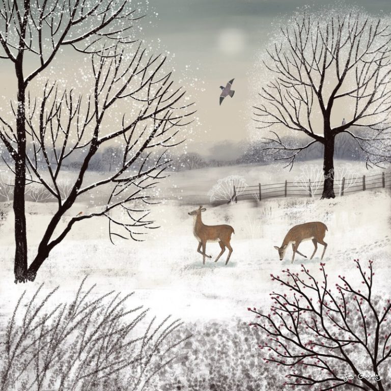
Hastings, Inky Acorn
Illustrated maps shine because they work like visual magnets. Colour, drawings, and icons instantly pull your focus where it matters. These maps are far from flat or stuffy. Studies using eye-tracking even show that people spend more time looking at maps packed with visuals. We can all relate—our eyes pause to enjoy a quirky drawing much longer than a plain line.
The right mix of colour and art doesn’t just brighten the page, it makes every detail easy to spot. Instead of wandering from street to street, the reader’s eye lands right where the artist wants. The whole map feels alive, so people want to look longer, soaking in every corner for clues and stories.
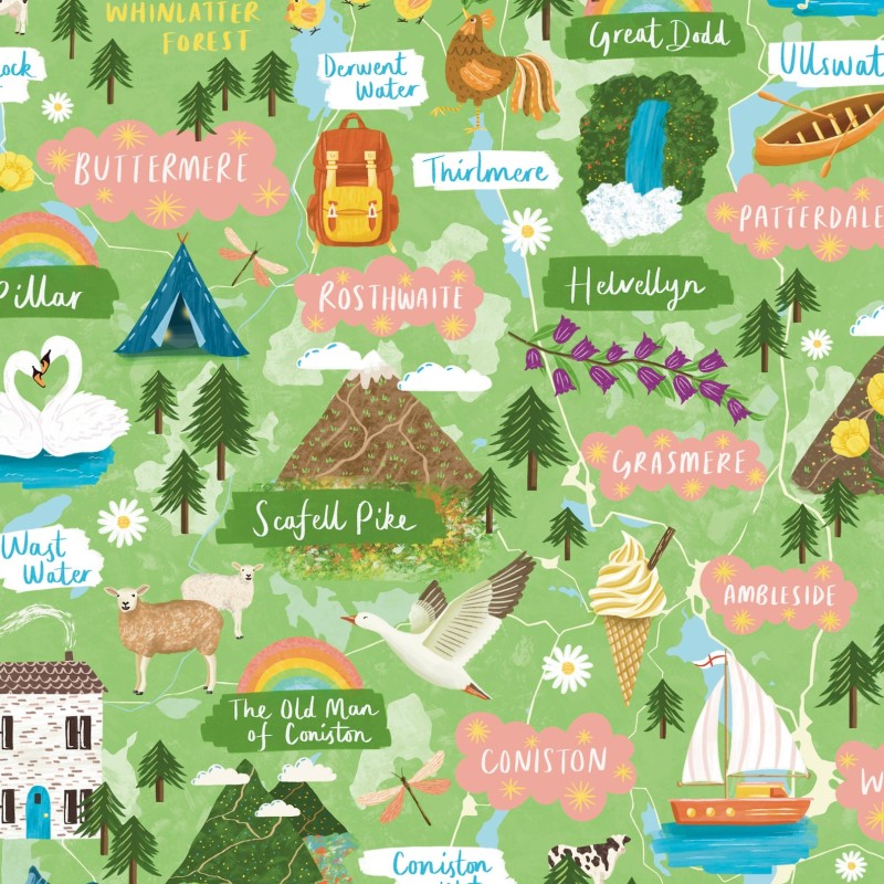
Use of colour and art
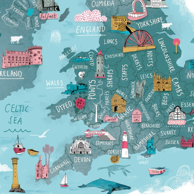
British Isles (not sure what the false teeth at the top are to do with?!)
Artists use bright, bold colours to highlight what matters most on illustrated maps. When a landmark, path, or symbol jumps off the page, confusion fades away. Suddenly, finding your way feels more like exploring a cartoon treasure map than reading a phonebook.
Every place has its own mood, and artists pick colours that match the heart of the community. In seaside towns, cool blues and sandy browns echo the water and beaches. For city life, warm bricks and street art shades fill the map with local energy. Careful colour choices create maps that feel personal, not generic or stock.
Here are some ways colour and art make illustrated maps more engaging:
- Clear focus: Bright shades show what’s important instantly.
- Local spirit: Colours and styles echo the local culture and personality.
- Eye comfort: A good palette makes maps easier to scan, less tiring to read.
- Visual cues: Drawings and icons anchor the map, guiding the reader naturally.
Storytelling through visuals
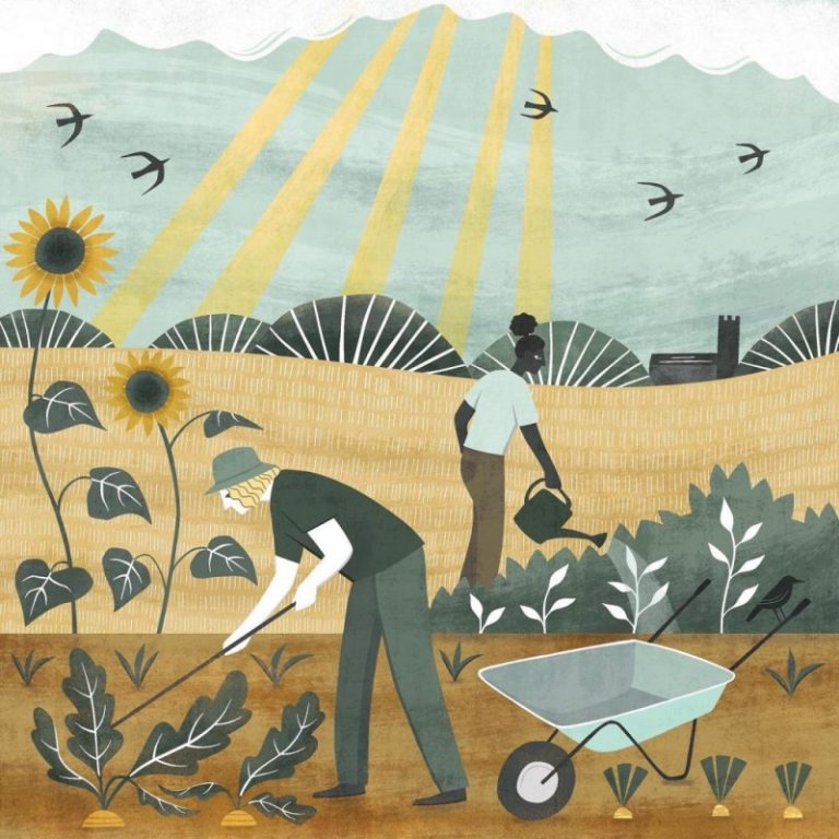
Every sketch tells a tiny story. Iconic buildings, street musicians, or even a local cat can pop up as small drawings. These visual snippets spark memories that plain maps never do. Instead of just reading place names, people see what makes that place special.
Visual stories stay in our minds longer. Research in psychology suggests that when people see a drawing of a local festival or a park full of ducks, the image sticks. You can almost smell the food market or hear laughter from the playground. That makes the visit more memorable, even before you arrive.
Some storytelling tools found on illustrated maps include:
- Character sketches: Little figures add charm and tell who lives or visits there.
- Local landmarks: Art brings unique shops, statues, or buildings to life.
- Seasonal scenes: Trees in bloom, snow-capped rooftops, or festival lights set the time and mood.
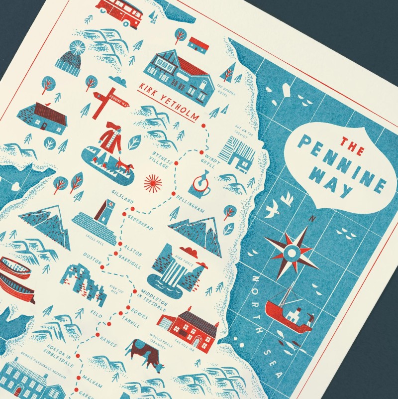
- Hidden jokes and icons: Artists slip in fun surprises that reward those who look closely. For instance, this artist creates Lap Maps, for many areas of England. When there is a hill or sharp bend, he writes ‘a bit hairy!’ to warn the reader. You won’t get this in an AA book!
Eye-tracking studies prove the point: people look longer at illustrated maps, and their gaze bounces to each clever touch. When maps feel like a colourful comic strip, readers want to explore every inch. This keeps them on the page and helps every place feel worth a visit.
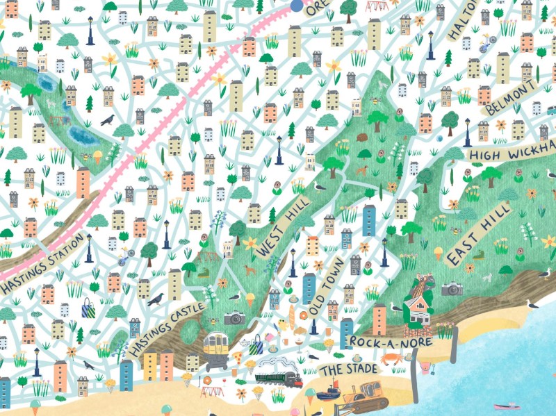
They Boost Community Engagement
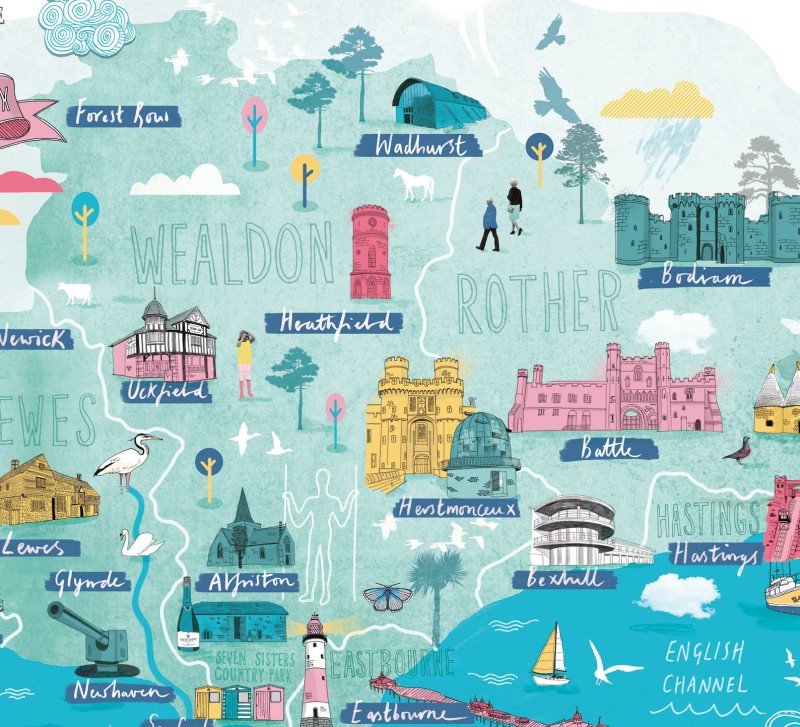
This East Sussex map is printed on recycled paper
When a new illustrated map appears, something changes in the way locals see their town. People spot small details that matter to them, and suddenly the place feels more personal.
Illustrated maps do more than guide us physically—they bring pride, conversation, and fresh moments of connection to each neighbourhood. It’s not just about finding your way, it’s about belonging.
Local artists get a platform
Illustrated maps are a lifeline for local artists. When a town or community commissions an illustrated map, they don’t just pay for direction—they hire someone to capture their home’s spirit. This is real work for illustrators, many of whom struggle for steady income. Every map commission brings new fans, repeat work, and word-of-mouth recommendations their way.
Artists often get to add their own flavour, style, and sense of humour to these maps. This personal touch makes each map unique. People start to recognise an artist’s signature details, whether that’s soft watercolours, playful cartoons, or bold marker strokes. The map doubles as a gallery, promoting their talent to the entire community every time someone uses it or shares it on social media.
These illustrated maps often reflect stories only locals know. When a map includes tiny drawings of the garden where kids set up lemonade stands or a mural painted by neighbourhood teens, it brings those hidden gems to the spotlight.
The pride is contagious. Residents share photos of maps online, tag the artist, and talk about the cool places captured in each drawing. Not only does the local art scene grow, but so does the love for the place itself.
- Commissions mean steady work for illustrators who might otherwise go unnoticed.
- Unique art styles stand out, making the map itself a conversation starter.
- Spotlighting community stories helps people feel seen and valued.
- Social media buzz follows every map release, spreading both the art and the pride.
Interactive map walks
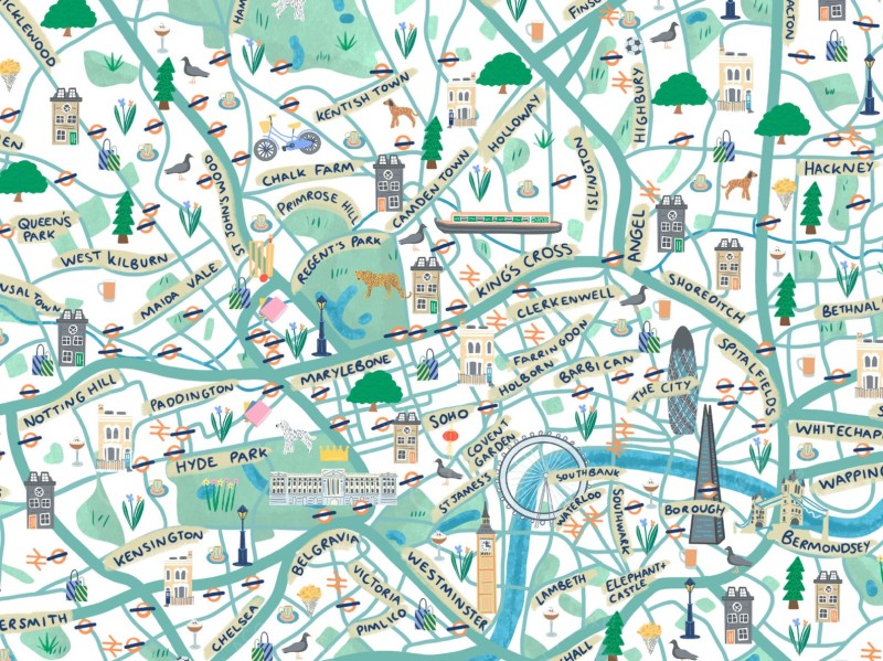
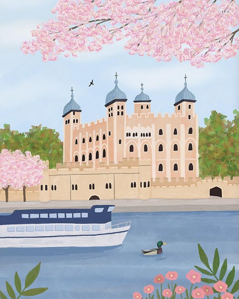
London, Inky Acorn
Schools and community clubs have found a new ally in illustrated maps. They now use these maps for group walks, field trips, or historic tours. Unlike generic fold-out maps, illustrated versions invite people of all ages to join in the fun.
Each icon or little sketch becomes a game or a prompt: “Who can spot the small shop cat?” or “Let’s find every animal drawn on the streets!”
Walking the neighbourhood with an illustrated map turns a basic route into an adventure. Clubs or school groups trace the path, stopping for stories at each landmark. Adults and children interact and share what catches their eye. Guided by drawings, the group experience feels playful and unhurried, sparking more conversation and laughter along the way.
Some towns even organise launch events when a new hand-drawn map comes out, turning them into reasons for neighbours to gather. In some cases, businesses and local history buffs help run map walks, using the illustrated details to share old tales, secrets, and facts that might have vanished otherwise.
When these events happen, social feeds fill with photos of people gathered around someone pointing out a cartoon version of their home or the park where everyone used to play.
- Map walks become shared adventures, perfect for families, clubs, or classes.
- Every walk strengthens local ties by mixing fun, art, and learning.
- Events built around map launches draw crowds and positive attention to neighbourhood hotspots.
- Photos and stories from walks encourage even more people to explore and engage.
Illustrated maps do more than guide; they invite everyone to see their patch with fresh eyes, stirring pride and sparking joyful little journeys every day.
Improved Understanding of Space
A great illustrated map is like a friendly guide in a busy place. It doesn’t just point the way—it helps you really see and feel your surroundings. If you’ve ever been lost in a maze of street names or struggled to match a map to real life, you know how much a clear visual makes a difference.
Illustrated maps cut through clutter, making cities, towns, and parks invite you in instead of push you away. Simple icons and sketches help people find what they need and actually remember where things are. Let’s look at two ways illustrated maps improve the way we understand space.
Simplified landmarks: Parks, cafés and bus stops
Most people don’t want to study dense grids or puzzle over rows of street names when planning a day out. Our eyes get tired of clutter. That’s where illustrated maps help the most.
Artists use small drawings—trees for parks, coffee cups for cafés, simple buses or benches for stops and stations—so your brain doesn’t have to work overtime.
Why does this work? The brain reads images faster than words. If you spot a little tree drawing, you know it’s a park without thinking. You see a croissant, you know there’s a bakery on that corner. No squinting to read tiny print or search for cryptic map symbols.
Here’s what these icons and sketches do on an illustrated map:
- Reduce confusion: Visual cues feel natural to the human brain and less tiring than reading lines of text.
- Make trip planning quicker: Simple drawings of key places mean you spend less time second-guessing which way to go.
- Help visitors and locals alike: Even if you don’t know the town, a simple café icon or a park bench sketch puts you on the right path.
Artists also arrange these icons to match how people move and see in real life. Parks appear bigger, high-traffic shops stand out, and extra details like playground slides or dog areas pop up for those who need them.
GPS maps and GIS layouts often show every single street or code, which confuses people who just want to find the nearest shop or bus stop. By clearing away clutter, illustrated maps let important landmarks shine, so finding what you need feels easy and stress-free.
Better memory retention with illustrated routes
There’s a good reason we remember doodles from childhood but forget most written instructions. Pictures stick. Illustrated maps use this to their advantage, helping people keep directions and locations in mind much longer than plain maps ever could.
Studies back this up. According to research published in the journal “Cartographic Perspectives,” people given hand-drawn or illustrated maps remember their routes and the layout of spaces with much more accuracy than those who used only text-based instructions.
Another study from the University of Utah found that when people used maps featuring both drawings and written directions, their recall of routes improved by over 35 percent.
Why do illustrated maps work so well? Here’s what the studies found:
- Visual memory is powerful: The brain can picture a hand-drawn bridge or market easier than it can recall a street name.
- Sketches build mental maps: Small drawings turn into mental landmarks, so you know what to look for on the street.
- Images snap together like stories: Our minds build a journey with pictures rather than just lines and words, so the path feels familiar before you even walk it.
Try remembering your last walk in a new city. If you followed a route with quirky drawings of towers, trees, or fountains, those images probably did more to guide you than any text ever could.
The result? When someone uses an illustrated map, they don’t just memorise turns—they almost feel the walk before setting off. That means fewer people get lost, and more come away with happy memories of their trip. Bold visuals paired with simple paths give the brain a leg up, turning short visits into lasting stories.
Table: Memory recall with different map types
- Text-only directions have 54% recall
- GIS/standard maps have 62% recall
- Illustrated maps have 87% recall
This shows why more illustrated maps should be part of daily life—they don’t just guide, they create easy memories and unlock better ways of finding your way in any space.
Economic Benefits for Cities
Illustrated maps do much more than make a place look good. When cities and towns use them, they unlock real economic value. These maps draw visitors, help local businesses stand out, and get people to explore spots they might miss.
Tourist boards, city councils, and shop owners all benefit from the lasting power of a well-made illustrated map. Illustrated maps can promote independent shops and public parks, and little nuances that the big map books miss.
Tourist appeal: Illustrated maps act as souvenirs
Tourist boards have embraced illustrated maps because they grab attention and spark curiosity. Unlike a simple roadmap, these creative maps double as keepsakes.
Many visitors start by picking up a map for directions, then end up taking it home. The hand-drawn touches feel personal, and tourists often keep them as fun reminders of places they explored.
The effect goes beyond pretty pictures. Illustrated maps show hidden alleys, quirky museums, and off-the-path cafés that regular maps skip. This gentle nudge gets people wandering and sticking around town much longer. When visitors see unique icons for local festivals or art walks, they often plan their day to fit in more stops.
You would not visit say the Lake District or Cornwall and bring back your family an AA routefinder, or visit the city and bring back your friend a copy of London’s A to Z. But you would possibly bring back a cute illustrated map of the area, that you found in a gift shop.
It all adds up to stronger city economies:
- Longer stays: Tourists who hang onto a souvenir map feel connected to a place, visit more spots, and stay another night or two.
- Word-of-mouth: People love sharing cheerful maps online, tagging places and businesses, which draws even more visitors.
- Larger groups: Families, schools, and friends use illustrated maps to plan group outings, so more people discover the area together.
A playful map of a seaside town with sketches of beach huts, surfers, and ice-cream stalls turns each street into its own adventure. The more engaging the map, the more tourists are likely to explore, buy local treats, and remember their visit fondly.
Support for local businesses: Custom Icons
For small shops, galleries, and cafés, being noticed can make all the difference. Illustrated maps work like miniature billboards for each business. Instead of getting lost among dozens of plain listings, places stand out with easy-to-spot custom drawings—a fresh loaf for the bakery, or a book stack for the local shop.
When an artist features a business with a fun icon, it’s no small detail. People will often pick their lunch spot, coffee stop, or shopping break based on an appealing drawing.
It’s a great way to direct foot traffic off the main drag and towards hidden gems. Many business owners ask to be included on the town’s illustrated map and sometimes even pay for the feature.
Benefits for shops and local services include:
- More visibility: An eye-catching icon draws attention even from people who had no plans to visit that street or neighbourhood.
- Impulse visits: A playful drawing creates a mood, triggering more pop-ins and sales as people wander by.
- Map-driven promotions: Business owners can highlight sales or events directly on the map, giving locals and tourists a reason to stop in.
- Community connection: Shops feel linked to the larger story of the town, sparking pride and stronger ties with both new and returning customers.
Tourist boards and city councils know this works. That’s why they often ask artists to include as many small businesses as possible, giving each a shot at new sales. Illustrated maps turn shopping and exploring into a light-hearted treasure hunt.
The more spots included, the more lively and inviting the whole area feels. Local economies get a real boost, one hand-drawn icon at a time.
Conclusion
Illustrated maps do more than help you find your way. They turn directions into fun, spark pride in communities, and help local shops thrive. These maps give every place a warmer feel, pulling people together with shared stories and happy discoveries.
If you want streets to feel more alive or wish hidden corners got noticed, consider asking for an illustrated map where you live. Or try making one yourself, even a simple version. Maps like these can change how you and your neighbours see your home.
Thanks for reading. If you have a favourite illustrated map or want to share your own, add your thoughts. Let’s bring more colour and connection to our towns, one illustrated map at a time!