England’s Beautiful Rivers: Explore Our Waterways

England’s rivers quietly shape the places we live, winding through countryside and city. They bring life to our gardens, offer peaceful places for picnics, and provide a home for wildlife. There’s more to these waters than just pretty views.
Let’s get to know some of England’s beautiful rivers, discover the types and habitats they support, and see easy ways you can help keep them clean and healthy.
Always follow the Countryside Code to keep all creatures safe. Keep dogs away from steep banks, mushrooms (and toxic plants/trees) and on leads near birds, barnyard friends and wild ponies.
If at the nearby coast, keep away from nesting birds and never walk on sand dunes. Learn how to keep dogs safe by the seaside (check beach bans before travel).
The Thames (one of the world’s cleanest city rivers)
Many people think that the Thames is England’s longest river (it’s not, that would be the Severn). It is the second longest river however, and is also known as one of the world’s cleanest city rivers in the world. A high achievement, considering that parliament used to have to close down years ago, due to the stench of pollution.
It’s also home to many birds and wildlife and marine mammals, who no doubt appreciate the huge efforts that have gone into making this river a safe place for living and swimming. And it also has many nice walks too.
Out walking? Follow the Countryside Code to keep all creatures safe. Keep dogs away from steep banks, mushrooms (and other toxic plants/trees) and on leads during nesting season.
Back in the 1950s, the Thames River was declared ‘biologically dead’. But today it has over 125 species of fish, including eels and endangered seahorses. Two-thirds of London’s drinking water is from here (and in blind taste tests, it beat the expensive bottled waters!)
There are over 200 bridges and 24 tunnels, so river enthusiasts will never get bored learning about all this river’s twists and turns. There are also 180 islands, including large ones and tiny islets.
At over 200 miles long, it starts as a small trickle in the Cotswolds of Gloucestershire, then goes through Oxford, Buckinghamshire and London, to the North Sea on the east coasts, it’s not just in London!
The river has big associations with the book The Wind in the Willows. Kenneth Grahame’s home was in Pangbourne. And just downriver from here is Mapledurham House, believed to be the inspiration for Toad Hall.
Read From Source to Sea. This is the tale of travel writer Tom Chesshyre, who walks the entire 200 plus miles of the river, along the way strolling past meadows, churches, palaces, country estates, council estates, factories and dockyards.
Henley-on-Thames’ sailing regattta
Another well-known sailing regatta is in Henley-on-Thames in Oxfordshire. Held since 1839, this time competitors row boats, rather than sail yachts.
It’s a highlight of the English social season, with a strict dress code. Men must wear a lounge suit or jacket (with trousers and tie) and women must wear dresses or skirts below the knees (or trouser suits) and are encouraged to wear hats.
Former MP Boris Johnson of course caused disgrace, by partying while people were not allowed to hold the hands of their dying relatives during the pandemic.
When he was considering standing again in this safe Tory seat to return to politics, one local member of the Conservative Association said the former Prime Minister would only take up his old seat ‘over my dead body’.
The Thames (a river rich with history)
The 215-mile River Thames is often thought of as a ‘London river’. But England’s second-longest river (after the Severn), actually begins in the Cotswolds and flows through Oxford out to the North Sea. The Thames used to be so polluted, that Parliament would have to regularly close down due to the stench. Today it’s much cleaner.
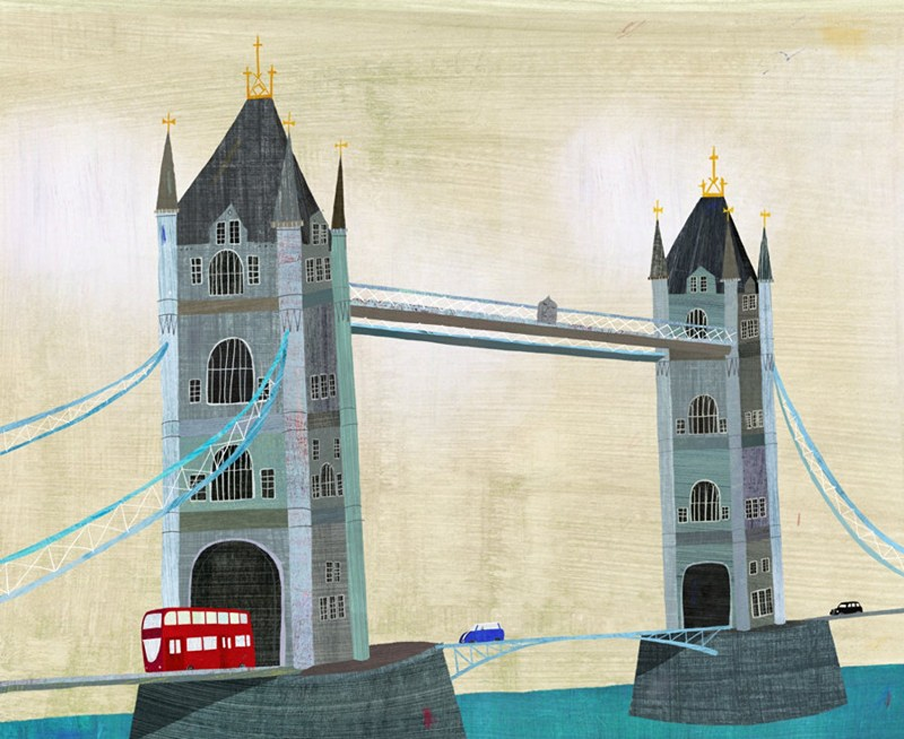
Tower Bridge was built in the late 1800s, to give people better access to the East End. Often confused with London Bridge (half a mile away), the urban (denied) legend is that an American (who wished to move the bridge to Arizona) bought the wrong one!
The bridge opens for ships to pass. In 1952, a double-decker bus began to slide as the bridge accidentally opened. Driver Albert Gunter made a split-second decision to accelerate to clear the gap (like the film Speed, when the road wasn’t built). There were no serious injuries. So he was awarded the princely sum of £10!
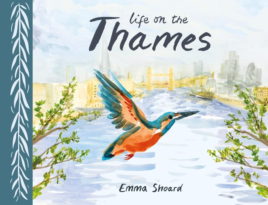
Life on the Thames is an illustrated journey along a river that sustains a staggering number of birds and mammals. Swans, geese, herons, and cormorants are regular sights, as are 120 species of fish. Otters have made a comeback upstream, as water quality has improved.
Opened in 1984, the Thames Barrier is one of the world’s largest movable flood defences. It sits downstream of central London and protects the city from storm surges. The barrier can be raised in less than two hours, when high tides and storms threaten the capital.
The Thames Path is a 184-mile (294-kilometre) walking trail following the river from its source to the sea. You can join it in city or countryside. The path takes in urban parks, rolling fields, and bustling towns.
Walking the Wharfe (ode to a Yorkshire river)

Walking the Wharfe is by local boy Johno Ellison, who returns from living abroad to walk the entire length of the waterway where he grew up.
Retracing the steps of Victorian writer Edmund Bogg, he begins in the Vale of York, walking upstream to find Victorian spa towns and rare red kites that have returned, thanks to conservation initiatives.
He is seduced into wild swimming a chilly river (not the section notorious for reportedly drowning everyone who has ever tumbled into it). And seeks refuge in a candlelit pub, during a power blackout.
River Wharfe winds for 65 miles through the heart of Yorkshire. It begins in the village of Buckden, then flows through beautiful countryside, before joining the River Ouse.
The river is home to otters, kingfishers and herons, looking for fish. Rare wildflowers and mosses thrive on this river’s limestone edges.
Stay away from The Strid, a dangerous gorge where the river is forced through a gap of 12 feet. With underwater caverns, it has 100% mortality rate, for anyone who falls in. The water can rise 5 feet in minutes, and never increases in temperature, even in summer.
The Flow (a journey along Cumbria’s River Rawthey)
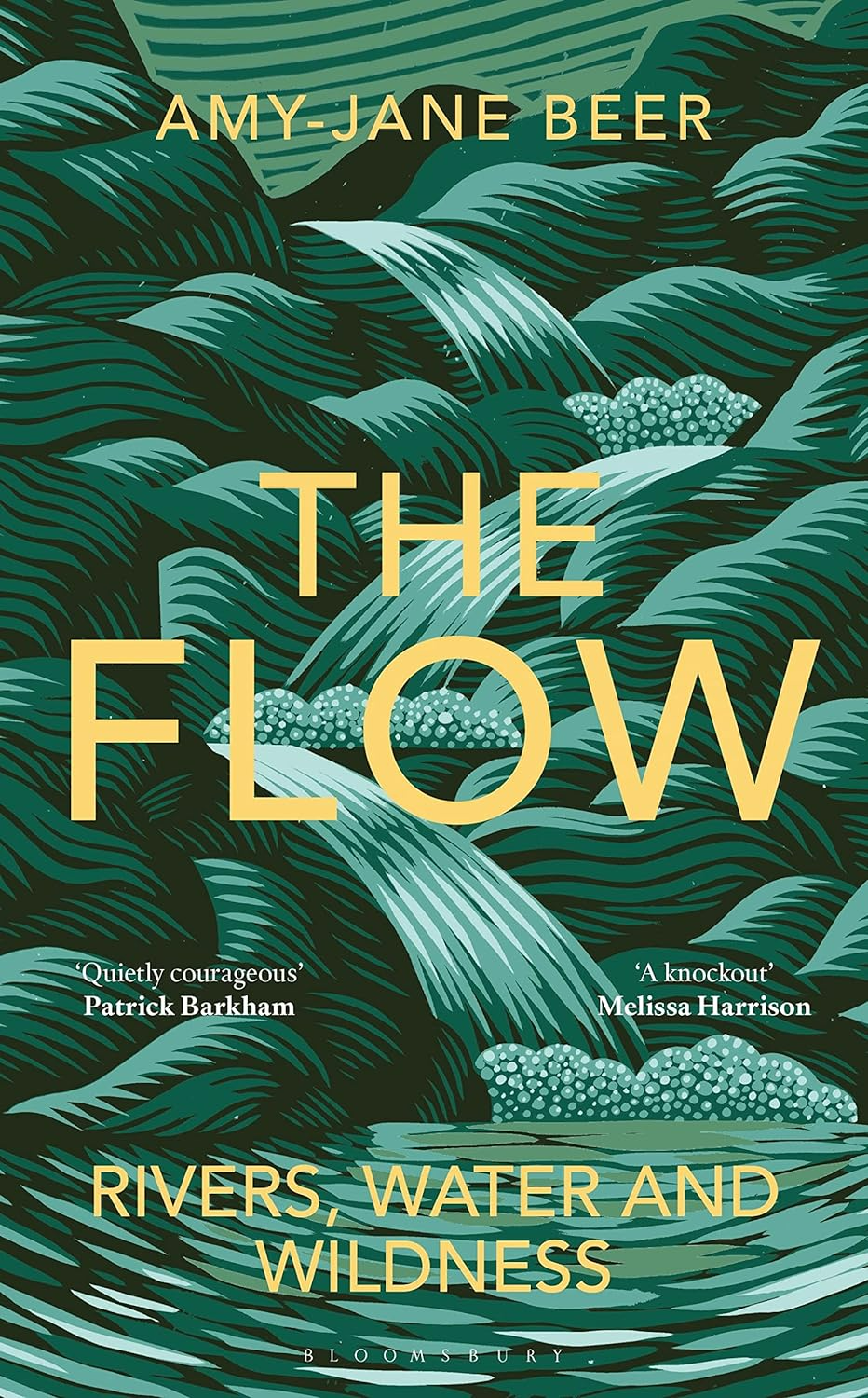
The Flow is a a writer’s journey along the rivers of England, taken after her beloved friend Kate set out with others to kayak the River Rawthey (Cumbria). But she never returned, and her death left her family and friends unmoored.
From West Country torrents to Levels and Fens, from rocky Welsh canyons to the salmon highways of Scotland – through to the chalk rivers of the Yorkshire Wolds, Amy-Jane follows springs, streams and rivers to explore tributary themes of wildness and wonder, loss and healing, mythology and history.
The River Rawthey is a scenic river in Cumbria, which flows through the Howgill Fells and Yorkshire Dales National Park. It originates near Baugh Fell, and turns towards Sedburgh, where it joins the River Dee.
The river is fed by several streams and flows through a broad, U-shaped valley. It flows near England’s highest waterfall above ground (Cautley Spout). And also passes near the 400-year Cross Keys Temperance Inn, managed by National Trust.
Other major rivers of England
Here are a few more of England’s major rivers:
Southwest England
- Bristol Avon River (75 miles) begins in the hills near the village of Acton Turville in south west England, flowing through several towns and the city of Bath. Before reaching the city of Bristol and flowing into the sea at the Severn Estuary.
- River Severn (220 miles). This is England’s longest river that starts in the Welsh Cambrian Mountains, flows through Shrewsbury, Worcester and Gloucester, before reaching the sea at Bristol.
- River Wye (135 miles). This begins in Plynlimon (Wales), then flows through hills and woods, almost a gentle border between Wales and England. Before joining the River Severn in Chepstow (bordering Monmouthshire with Gloucestershire).
The Midlands
- River Derwent (72 miles) is a tributary of the River Trent, flowing through Derbyshire and Yorkshire, covering parts of the Peak District. A tributary is simply a small river that flows into a bigger one. It helps to ‘fill up’ the larger river, and keep it flowing.
- River Nene (100 miles). This begins in Badby (a village in Northamptonshire) and runs through Northampton, Wellingborough and Peterborough, before again ending up in the North Sea.
- River Trent (185 miles). This flows through central England, beginning in Staffordshire and ending up again in the North Sea (Humber Estuary).
- River Teme (81 miles) again forms a border between Wales and England, passing through the towns of Knighton, Ludlow and Tenbury Wells, before joining the River Severn in Worcester.
East of England
- River Great Ouse (143 miles). This begins in a village (Syresham) in Northamptonshire, then flows through Buckinghamshire, Bedfordshire and Cambridgeshire, before ending up in the Wash, on the east coast.
- River Medway (70 miles) begins in Sussex and moves through Kent towns (Tonbridge, Maidstone and Rochester) before reaching again the North Sea.
- River Witham (82 miles) begins in South Witham (a Lincolnshire village) before flowing through the city of Lincoln, and again reaching the North Sea at The Wash. Brayford Pool is an inland harbour, formed when the river naturally widens.
Northern England
- River Aire (71 miles) begins in the Yorkshire Dales, and passes through several towns and cities including Leeds and Castleford. It then flows to join the River Ouse.
- River Don (70 miles) begins in the Pennine Hills, then flows through South Yorkshire (Sheffield, Rotherham and Doncaster). Today the river is cleaner than it used to be, as it was very polluted due to the factory pollution, during the Industrial Revolution.
- River Eden (90 miles). This begins in the Cumbrian hills, then flows through the city of Carlisle, before reaching the Solway Firth, an inlet forming a natural border with Scotland (and quite close to the Isle of Man).
- River Mersey (70 miles) begins in Stockport (Cheshire) when small rivers join up, to flow through Manchester and Liverpool. It then flows out to to the Irish Sea. This river is very well-known, thanks to the song ‘Ferry Cross the Mersey’.
- River Ribble (75 miles) begins in Ribblehead (North Yorkshire) and flows through Settle, Clitheroe and Preston, before reaching the Irish Sea (close to Lytham, near Blackpool).
- River Tees (70 miles) begins in the Pennine Hills, and starts off very steep (it includes High Force, one of England’s highest waterfalls). Before moving along flatter land, it passes through Middleborough and Barnard Castle, before reaching the North Sea.
- River Tweed (96 miles) is a river that begins in the Scottish hills, then travels for 97 miles, before reaching England for the last few miles, at Berwick-upon-Tweed (Northumberland). The river forms a border between the two countries.
- River Tyne (73 miles) begins where two small rivers meet near Hexham (Northumberland). It moves east towards the North Sea, passing through Newcastle and ending between the towns of Tynemouth and South Shields.
- River Ure/River Ouse (combined 129 miles). These are two North Yorkshire rivers that flow into the other. The River Ure begins in the Yorkshire Dales, then as it reaches York, it becomes the River Ouse.
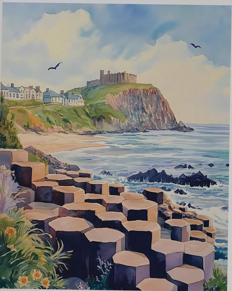
Still Waters and Wild Waves (50 original illustrations)

Still Waters and Wild Waves is a beautiful book to capture the waves that move us. It features over 50 original illustrations of dramatic seascapes and reflective rivers, alongside photography of stunning places that inspired the author’s artwork.
A blue-green sketchbook sits at the edge of my studio desk. It is covered in decorative paper, and is now frayed and tattered. These marks are evidence of its travels – as far north as Shetland and as far south as Isles of Scilly.
It has sat beside me on beaches and cliff tops, on small island planes and huge ferries, on trains and bicycles.
Some of the pages are stained with Scottish rain and spilt coffees. This sketchbook holds scribbles and memories that tell the tales of still waters and wild waves.
Angela Harding lives in England’s smallest county of Rutland, working from a studio at the bottom of her garden in a small village.