Lap Maps (easy to read illustrated walking maps)
Do you get confused when trying to read perfect but boring map guides? Lap Maps are a breath of fresh air! They are not completely to scale, but each one is super-interesting and sometimes funny, offering an array of walking maps and guides for the Lake District, Northumberland, the Peak District and the Yorkshire Dales.
There are also some for Wales, if you are holidaying over the border.
Printed locally with sustainable-sourced paper, the guides make visiting somewhere interesting and fun, with a friendly illustrated guide alongside, if you’re not good at reading normal maps!
Always follow the Countryside Code to keep all creatures safe. Keep dogs away from steep banks, mushrooms (and toxic plants/trees) and on leads near birds, barnyard friends and wild ponies.
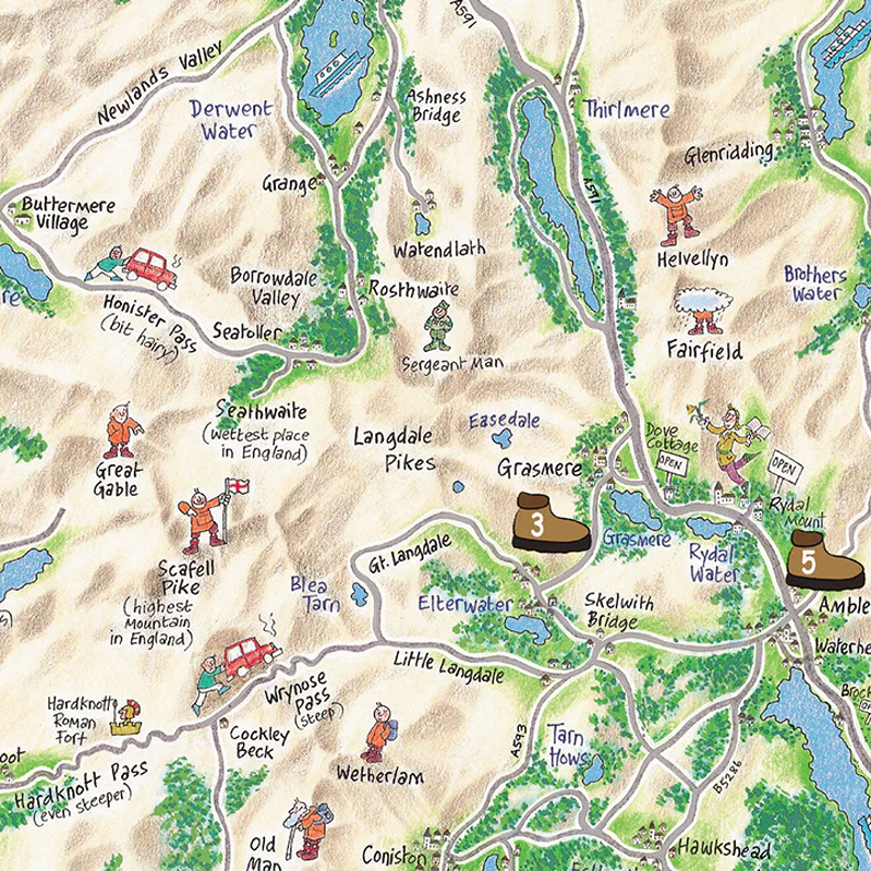
As an example, the Lake District map is hand-drawn by artist Colin Shelbourne, with individual walk route maps on one site, and descriptions and useful information on the other. It also folds down to fit in a jacket pocket.
For this map, you’ll find walks including:
- Buttermere
- Grasmere
- Ullswater
- Stockghyll Force
- Ambleside
- High Sweden Bridge
- Ambleside
- Bowness
- Hill Top (home of Beatrix Potter)
- Orrest Head (Windermere)
Each walk includes an easy to use map with distance and numbered written directions, and information on points of interest, views and alternative routes.
These maps are in the spirit of English humour! For instance, if there is a route that is not for the faint-hearted, the description reads ‘a bit hairy!’
Plus you have little men and numbered walking boots, to help you get around!
You’ll discover notes like ‘wettest place in England’ (Seathwaite). And if you’re attempting to climb a mountain, you’ll find a little man with a flag to inspire you (please don’t really plant flags at the top, they just create more litter).