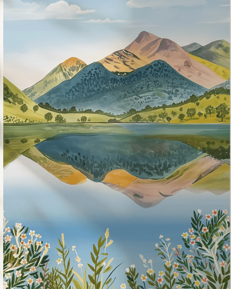
Discover The Ten National Parks of England
England has 10 national parks, which are protected from building (we have far less than Turkey, which has 60!) Here is a quick guide to some of our most stunning scenery in England.
Always follow the Countryside Code to keep all creatures safe. Keep dogs away from steep banks, mushrooms (and toxic plants/trees) and on leads near birds, barnyard friends and wild ponies.
If at the coast, keep away from nesting birds and never walk on sand dunes. Learn how to keep dogs safe by the seaside (check beach bans before travel).
How to upright an overturned sheep
Pregnant sheep (and sometimes due to wool waterlogged from rain) can sometimes roll over onto their backs, and can’t get back upright, due to having four stomach chambers (so will die if not turned back upright).
If you see a sheep on its back, just firmly right it back, then stay with it, until rain has drained off, so it won’t happen again. Then inform your local farmer.
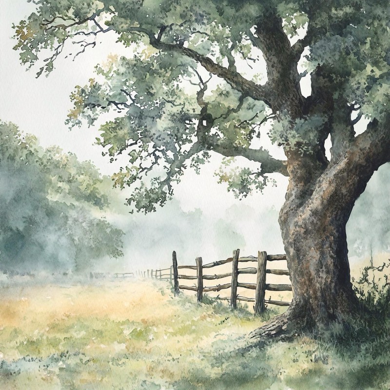
The Yorkshire Dales (stone villages & waterfalls)
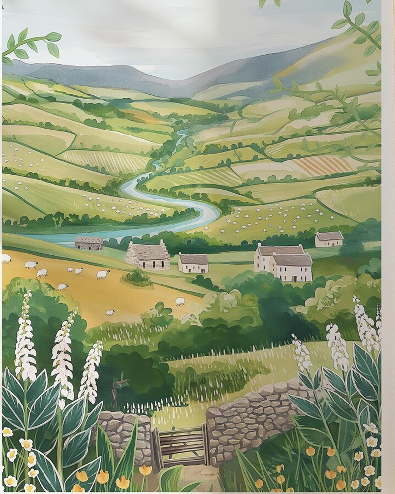
The Yorkshire Dales is home to many stone-built villages and dramatic waterfalls, amid heather moorland that stretches into Lancashire and Cumbria.
It’s home to 100 species of nesting birds, 30 species of mammals, 25 species of butterflies, 1000 species of moth and a unique moss not found elsewhere. Here also lives the brown long-eared bat (his ears much longer than his body!)
The Dales has complex cave systems including Gaping Gill, which features the highest unbroken underground waterfall. Here you’ll also find the famed Settle-to-Carlisle Railway and its 24-arch Ribblehead Viaduct.
The word ‘dale’ is from the 12th century Old English/Norse ford for ‘valley’. Alas today over 20% of the 13,000 plus buildings in the National Park are holiday homes, which prices local people out of buying their own homes, if they are on lower incomes than second home owners.
The North York Moors (heather and ancient trees)
The North York Moors are wild and open, stretching from Thirsk and Helmsley to the Yorkshire coast at Whitby. Some valleys are dense with pine forest, while late summer bring purple heather that rolls over high moorland. This historic natural haven is a haven for walkers.
Covering 44,000 hectares, the North York Moors features on of England’s largest expanses of heather moorland, plus is home to many ground-nesting birds like golden plovers and merlins. It also has one of northern England’s largest concentrations of ancient trees.
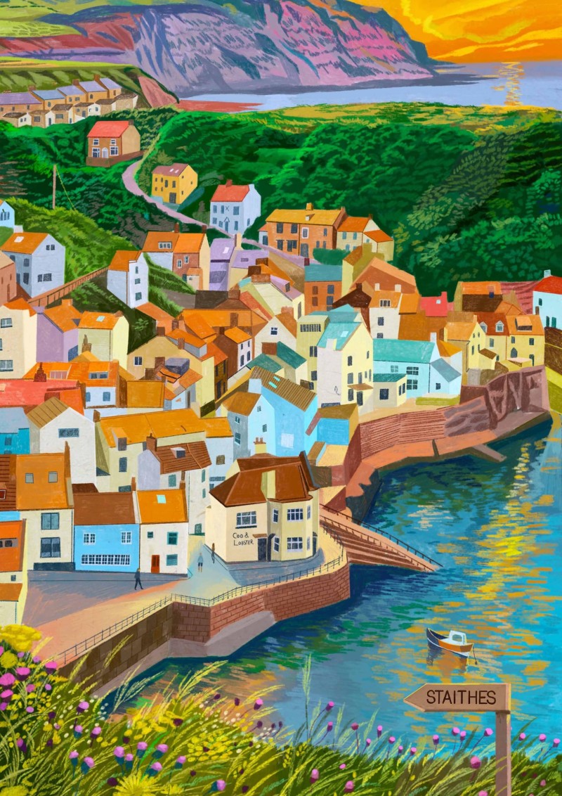
Stretching to the Yorkshire coast
Not just inland, this National Park stretches to the Jurassic cliffs of the Yorkshire coast, with ancient villages like Staithes and Robin Hood’s Bay (where you paddle your toes, at then of Wainwright’s Coast-to-Coast Walk, which begins in St Bees in Cumbria.
Hikers can follow the horseshoe-shaped Cleveland Way, which winds around the park for 109 miles. You can also take in plenty of star-gazing, as the Moors are a designated International Dark Sky Reserve.
In late summer, the open tops of the North York Moors turn purple, while the valleys below stay green and shaded. Heather runs over the high ground in broad sheets. Then, almost without warning, old woods gather in the folds of the land, with ash, oak, birch and twisted trunks catching the light.
This national park sits in North Yorkshire, between inland hills and the coast. What makes it feel so special is the contrast. You get wide, wind-brushed moorland, then deep dales and hidden trees. Heather and ancient woodland shape the look of the place, but they also shape its wildlife and history.
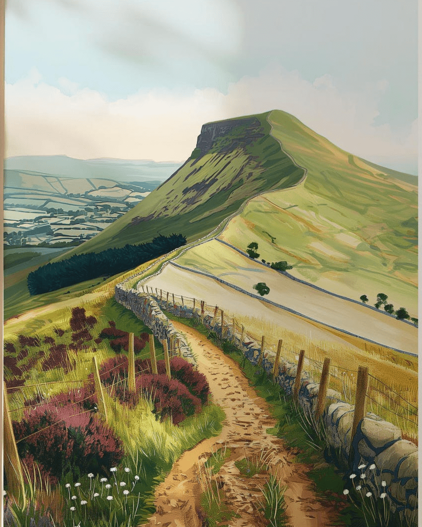
The Peak District (England’s oldest national park)
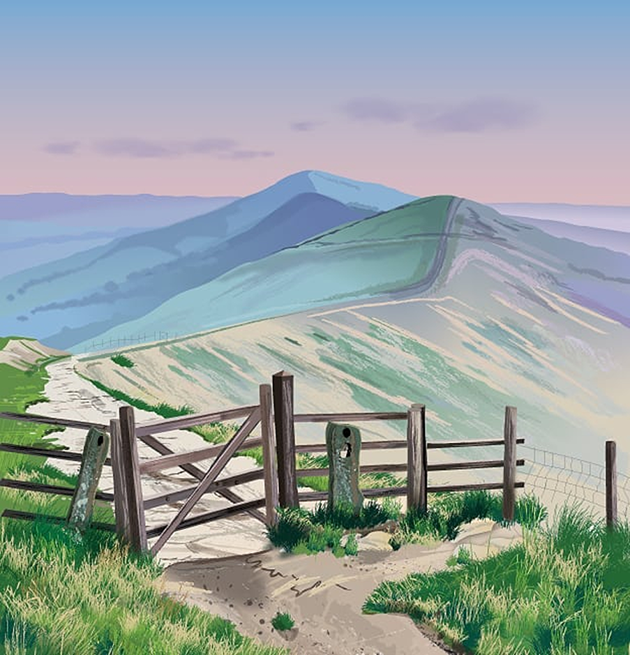
The Peak District is England’s oldest National Park, opened in 1951, after years of campaigning by local people for people to have access to walking country near Manchester and Sheffield. Before that, many areas were banned to the public by rich landowners.
The park covers over 550 square mils of rolling hills, valleys and villages, and is mostly in Derbyshire, but rolls into nearby counties. It’s the most popular park due to being so accessible to millions of people.
The Dark Peak is known for gritstone edges, peat moorland, and big skies. Walks here can feel wide, windy, and slightly stern, like Kinder Scout and Stanage Edge.
White Peak has gentler limestone dales, caves and green pastures. Paths often follow streams or thread between dry-stone walls. Dovedale is the best-known example, with stepping stones and steep-sided valley views.
The Peak District isn’t just for boots and waterproofs. Bakewell brings together local food, stone buildings, and a town centre that still feels lived in. It makes a good base, but it also stands well on its own for a short visit. Learn how to make vegan Bakewell tart!
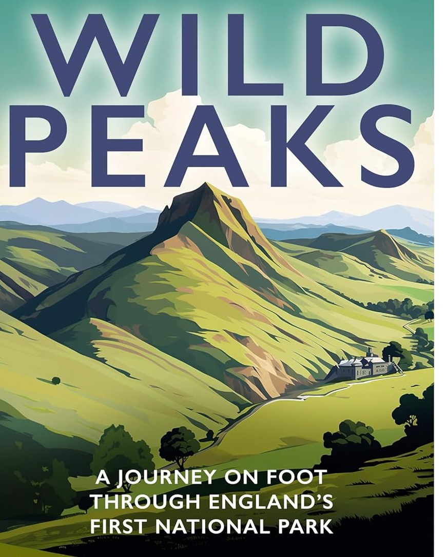
Wild Peaks is a journey on foot by travel writer Tom Chesshyre through the Peak District National Park, which is more than the ‘howling wilderness’ that Daniel Defoe described 300 years ago.
Designed to let hikers escape from industrial Manchester and Sheffield, this Park is home to ridges of rock, peat, farms, villages, cloughs and taverns.
How has the dramatic landscape fared in the last 75 years? Tom hits the trails on a 363-mile ramble to find out, and to celebrate the symbolic home of hiking. Following winding paths, passing at old inns and mountain huts and meeting a rich cast of historians, mountaineers and publicans.
The Lake District, Cumbria
The Lake District is England’s largest National Park, home to all of England’s highest mountains, its deepest lake (not Windermere, that’s not a lake!) and stunning scenery.
Exmoor and Dartmoor (small National Parks in Devon)
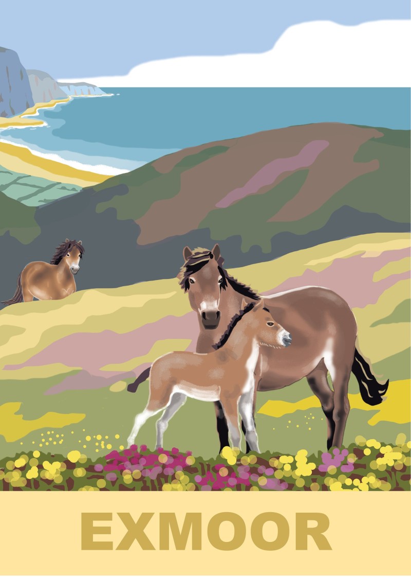
Exmoor is England’s only National Park with a coast. It has the highest sea cliffs in mainland Britain and Tarr Steps (the longest remaining clapper bridge).
Never light fires, stoves or barbecues in National Parks (wild camping is not allowed).Both parks are home to wild ponies, so never disturb or feed them. For concerns, contact the Livestock Protection Officer (Dartmoor), Exmoor Pony Society (and Moorland Mousie Trust).
Here also you’ll find endangered butterflies (the heath fritillary is here, found in only four places in the UK, due to loss of habitat). Exmoor was Europe’s first International Dark Sky Reserve, the ancient landscape (some places over 200 million years old) home to herds of wild red deer.
Dartmoor is 954 square kilometres, making it one of southern England’s largest open spaces, home to over 160 granite tors. Much of this park is owned by Prince William (passed to him when his father became King).
Land campaigner Guy Shrubsole says a lot of this land needs to be rewilded, as it is ‘devoid of trees and birds for miles’. Campaigners say the ‘small potatoes’ offered is not enough to restore ‘England’s rainforest’
The South Downs (East and West Sussex)
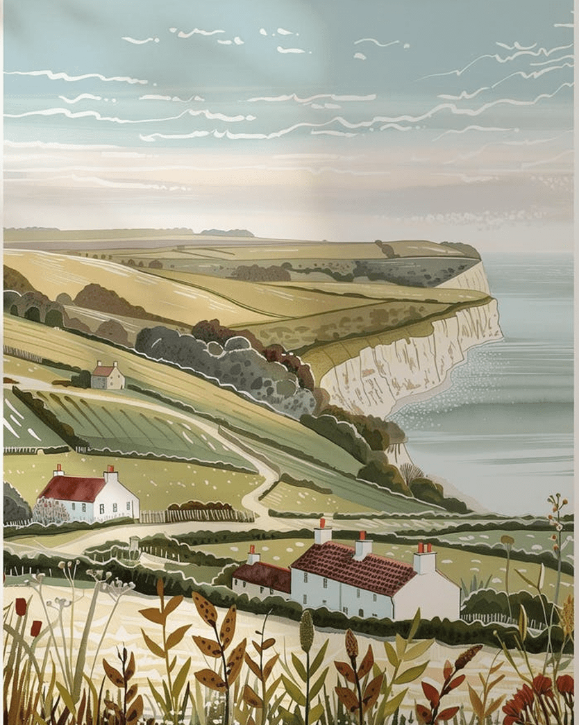
The South Downs National Park stretches from Winchester (Hampshire) to Eastbourne (East Sussex). It’s mostly known for its chalk downs, and beech woods that glow with copper hues, when autumn arrives. Many villages (like Amberley) lie nestled in the valleys, with old pubs and hidden churches are ‘old England’.
This park is an International Dark Sky Reserve, free from light pollution. This attracts many wildlife species from butterflies to skylarks and shy deer (who hide in ancient woodlands). Barn owls can safely hunt at dusk, and local nature reserves help to protect rare bats, dormice and orchids.
The South Downs Way is a 100-mile national trail that runs across the heart of the park. It’s well-marked and open to walkers, taking you through open hills, secret valleys and quiet forests.
The long man of Wilmington
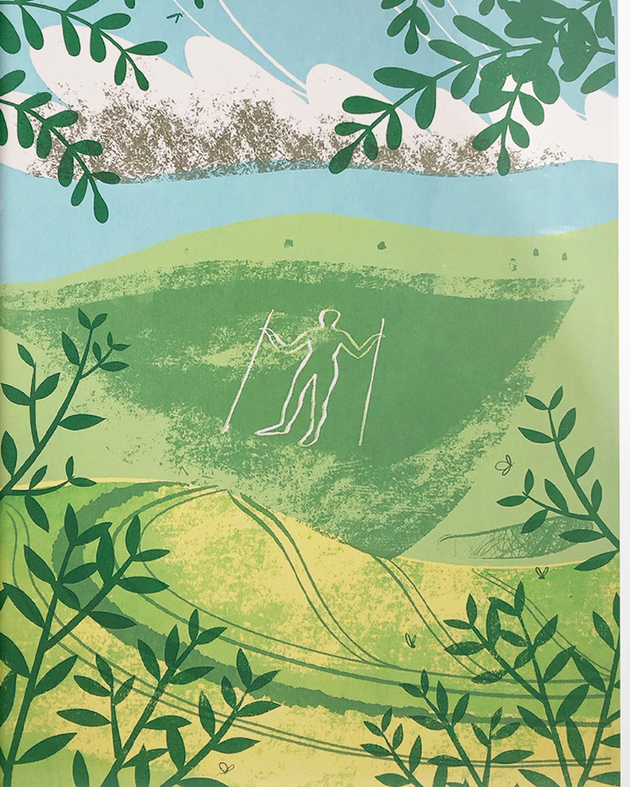
The Long Man of Wilmington is a 70ft giant man carved into the chalk hills of South Downs National Park near Alfriston (a pretty ancient Sussex village). His origin and reason for carving him have remained a mystery for generations.
We know he is over 300 years old (due to a sketch of him in 1710), and some believe he could have been carved as early as the Iron Age, or in Roman times.
In 1920, the chalk had faded, so locals and historians gave him a makeover with chisels and paint, and today there are surrounding concrete blocks, so he is easier to maintain!
The Long Man holds a stave in each hand, perhaps to symbolise his strength, to measure the land, or perhaps he was an astronomer? Or is watching over the fields? Nobody knows. One tale is that he marks the site of eternal rest, of two giant brothers who roamed the South Downs, and fell in battle.
If you wish to visit the Long Man without a big hike, it can be viewed from nearby Wilmington Priory. Nearby is the Litlington Chalk Horse, much smaller and carved into the hill in 1924.
The village of Litlington sits on the bank of the River Cuckmere, dating back to Domesday times. It’s home to one of the smallest churches in England, a charming architectural gem inspired by Gothic design, built in the 13 century. So is much older that its horse friend, by several hundred years!
Seven Sisters and Beachy Head
Seven Sisters and Beachy Head are the postcard views, and for good reason. The white cliffs rise cleanly from the sea, and the coast path gives one striking view after another. On a bright day, the chalk almost glows. In mist, the same coast feels softer and more distant.
This is one of the most photographed parts of the South Downs, yet it still feels spacious if you walk a little further. The cliffs are beautiful, but they need respect. Keep well back from edges, because chalk can be unstable. Also check the weather before setting off, especially if wind or low cloud is forecast.
The New Forest National Park (don’t disturb wild ponies)
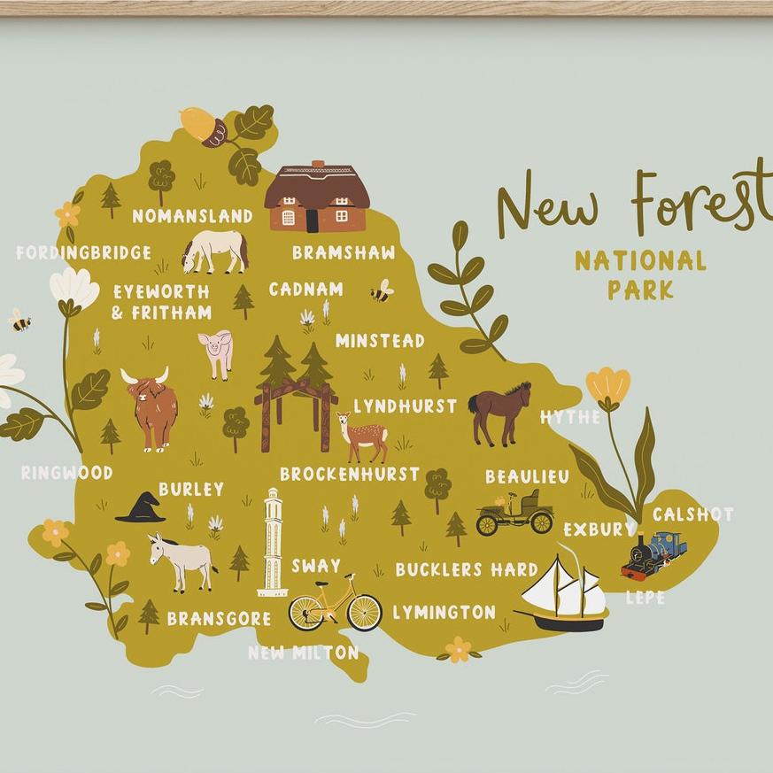
The New Forest is one of England’s National Parks, located in Hampshire and Dorset. It contains some of England’s oldest trees (some over 1000 years old) and large expanses of open heath, bog and grassland.
It’s one of the few places in England that’s home to all six native reptiles, and is also home to 75% of the world’s species of dragonflies.
Don’t light fires, stoves or barbecues (wild camping is not allowed).
The New Forest ponies (do not disturb)
The New Forest Ponies are cared for by commoners (who benefit from right to graze animals). The New Forest Verderers employ five Agisters who ensure commoners abide byelaws, and oversee grazing ponies, livestock, cattle, donkeys, pigs and sheep (but not deer or other wild animals).
Do not touch or feed semi-wild New Forest ponies. Don’t let dogs approach or chase ponies or any other animals. Never use flash photography (use a zoom lens if taking photos).
Sick and injured animals can be reported to the Verderer and Agisters website. This page includes numbers to call and details of penalties, for failing to report incidents.
Ponies wander onto lanes and streets, so drivers must slow down and pay attention. Local signs warn visitors to watch out for ponies, especially at dawn and dusk, when they often cross busy roads.
Road Traffic Accidents involving ponies, cattle, donkeys, pigs and sheep must always be reported immediately to the Police on 999.
Burley (a village with an interesting history)
Burley is a pretty village in the heart of the New Forest, you would never know that it had such a dramatic and unusual history. In the 1950s, it was home to Sybil Leek, a ‘white witch’ (presumably like the one in the Wizard of Oz’), who swore she used her power to do good, and the village even had an annual fairy festival.
Frequently seen walking through the village with a black cloak on the way to her antique shop, she was once challenged to ‘call up the wind’ on live TV and apparently did it. That’s not to say there is no power in these spectacles, but many of us prefer to just stay in church and say our prayers, it sounds far safer!
Close friends with actress Vivien Leigh, there were even rumours that Winston Churchill used her to provide ‘fake horoscopes’ to confuse the Germans (Hitler was very interested in the occult). Her reputation however made some locals uneasy, and when the landlord refused to renew her lease due to being a witch, she emigrated to the USA instead, rather than give up her broomstick.

The village had a more recent jolly resident. Can you recognise who it is above? It’s actor Buster Merryfield (when he was a bank manager), before he took up one of TV’s best-loved roles as Uncle Albert in the hit TV comedy Only Fools and Horses.
He only started acting age 57 and unlike his rum-loving character, in real life he never drank or smoked. He married his wife after a week-long whirlwind romance, and they remained together for 57 years (they are buried together in a nearby grave).

People thought that no-one could replace the wonderful Leonard Pearce (above as a young actor, who played ‘granddad’ and died of a sudden heart attack) but he ended up just as popular.
Pearce toured Germany as a young actor. And (not knowing what would happen), he innocently shook hands backstage with Adolf Hitler. He later told co-star Nicholas Lyndhurst that he regretted not grabbing a bodyguard’s pistol and killing him.
Despite his ‘idiot’ character, Leonard for a classically-trained actor who had worked for the National Theatre and Royal Shakespeare Company.
The Norfolk Broads (England’s ‘Amazon’ wetlands)
Norfolk is a large dry and mostly flat county in the east of England, the coast facing the North Sea, the coldest on earth! It’s pretty chilly in these parts in winter, so bring an extra jumper.
The Norfolk Broads (manmade wetland waterways) are home to 25% of England’s birds and native wildlife (including rare Swallowtail butterflies).
Known as ‘England’s Amazon’, the Broads are home to many creatures you likely won’t find elsewhere in England these days: bitterns, marsh harriers, swallow butterflies and fen raft spiders all find safe haven here. As do avocets, wading birds with unique upturned beaks.
There are seven rivers and over 60 broads (bodies of water). They span over 120 miles of rivers and lakes, created from flooded medieval peat diggings.
The Broads are also one of England’s most popular boating holiday destinations, so be a sustainable sailor, to protect local birds and wildlife. Canoeing is also popular, with plenty of quiet corners to explore. Moor up at a riverside pub, or just drift along and watch the world go by.
A wetland shaped by people, then nature
The story begins in the Middle Ages. People dug peat here for fuel, and they cut deep pits into the soft ground. Later, rising water flooded those pits and joined them to rivers. Over time, the old workings became the broads, those open stretches of water that now define the area.
That origin matters because it explains why the place feels slightly unusual. These are not natural lakes in the usual sense. They began as working ground. Then reeds spread, fish moved in, insects bred in the shallows, and birds found cover and food. So the Broads became a wetland where history and nature sit side by side.
By boat, you move through a maze of channels, broad water, hidden dykes and reed-fringed edges. Life gathers around the water. Birds hunt above it, fish move below it, and villages seem to lean gently towards it. Because of that, the Broads can feel like another world, calm, green and lightly wild.
Birdlife is one of the main reasons people come. Herons stand still at the margins, looking half-formed from the mist. Marsh harriers drift over the reed beds with slow, steady purpose. A kingfisher flashes past like a thrown jewel, gone almost before you register the blue.
The Broads are also linked with the swallowtail, Britain’s largest butterfly. It is one of the area’s best-known species, and for many visitors it becomes the moment they remember. One sweep of those cream and black wings can turn a quiet walk into something vivid.
The scenery shifts quickly here, and that is part of the pleasure. One hour you may be on a broad, open stretch of water under huge skies. Soon after, you slip into a narrow dyke with alder trees and high reeds closing in.
Then the human marks reappear. Old drainage mills rise from the marsh like patient sentries. Riverside villages such as Horning bring moorings, church towers and neat waterside gardens. On the grazing marshes, cattle stand in the distance and the flat light stretches for miles.
A year surrounded by marshy wildness
On the Marsh is a lovely book by Simon Barnes, who on hearing a Cetti’s warbler sing in Norfolk as he looked at a house for sale, moved there with to avoid the marshy land being lost to developers or intensive farming.
As he and his wife rewilded the area, this had calming effects for their son, who has Down Syndrome. A place of calm and inspiration for all.
Follow triumphs (two harrier families arrive to use the marsh as hunting ground). And disappointments (chemical run-off from neighbouring farmland creates a nettle monoculture).
The Suffolk Broads (peat pits to manmade wetlands)
The Suffolk Broads are (along with the Norfolk Broads) one of England’s most popular boating destinations. Wherry boats are the traditional way to get around here. Most rely on human power or wind, so they don’t pollute the water either. They also don’t have engine noise, a bonus for local wildlife.
Beccles is the main market town in the Suffolk Broads, sitting by the River Waveney. These streets have old buildings, little shops and cosy cafés. There are great views from the tall church tower in the centre of towns.
How peat pits became the Suffolk Broads
Peat bogs formed over long periods from partly decayed played. But once cut and dried, it served as useful fuel, so workers removed large amounts in the Middle Ages, and this left deep pits and channels in the soft ground. As water levels rose, river flooding increased. And the Broads were formed.
As this happened, industrial spaces became open broads, reeds spread and silt settled. Marsh plants moved in. In short, a working landscape turned into wetland.
Shallow edges warm more quickly than deep water, and that helps many plants and insects. Reeds give cover to nesting birds. Wet grassland offers feeding space. Slow-moving rivers connect one habitat to another, so fish, amphibians, insects, and water birds can move through the system.
A single broad can hold open water, reed fringe, fen, scrub, and marsh within a short walk. That variety supports species different needs. Some need shelter, some need mud, and some need calm water full of plant life.
- Reedbeds are among the most recognisable habitats. They shelter birds, insects, and small mammals. They also soften banks and filter water.
- Open water supports fish, aquatic plants, and feeding birds.
- Grazing marsh adds another layer. These wet meadows are shaped by water and long-term farming. They offer feeding grounds for birds and help keep the wider wetland open.